How to record GPS position on a Postgresql database using a Raspberry Pi - Tutorial
/Nowadays we can track GPS position with several devices as smartphones, wearables and handheld devices, but how can we store massive GPS positions on a effective way for later postprocessing, analysis and comparison with another device information. We have created a whole procedure enable the a GPS module as a serial device on a Raspberry Pi, then read the GPS information and sent it to a Postgresql database. The tutorial have several steps from the software installation, scripting to monitoring stored data.
Video
GPS connection
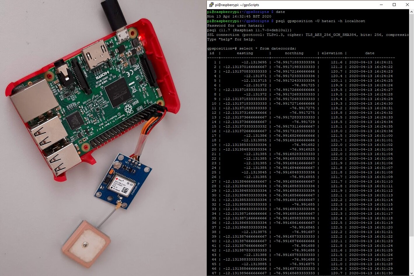
This the wiring for the UBlox Neo 6M:
VCC 3.3V (Pin 1)
RX TXD/GPIO 14 (Pin 8)
TX RXD/GPIO 15 (Pin 10)
GND Ground (Pin 6)
Check the Raspberry Pi pinout here:
From raspberry.org
Steps
On a session with the Raspberry:
Connect to wifi
Enable ssh on Preferences/Rasbberry Pi Configuration/Interfaces/SSH
Check the internal IP on terminal:
ifconfig
Conect through Putty (in Windows):
Host Name: pi@192.168.1.XX Port:22
Enable UART:
On prompt: sudo raspi-config
On 5. Interfacing Options / P6 Serial:
Would you like a login ... ? = No
Would you like the serial ... ? = Yes
Finish and Reboot
Check if gps send info to the serial:
cat /dev/serial0
Install postgres:
sudo apt-get update
sudo apt install postgresql
Check if database is running:
sudo service postgresql status
Create default user and table:
sudo -u postgres createuser --superuser pi
Create user:
postgres@raspberrypi:~$ createuser --interactive -P
Enter name of role to add: hatari
Enter password for new role: labs
Enter it again: labs
Shall the new role be a superuser? (y/n) y
Create table:
createdb -O hatari gpsposition
Check databases and create table:
psql gpsposition -U hatari -h localhost
\l
\c gpsposition
CREATE TABLE datecoords (
id serial primary key,
easting numeric,
northing numeric,
elevation numeric,
date timestamp
);
\d datecoords
Install sqlalchemy, psycopg2 and pynmea:
pip3 install sqlalchemy
pip3 install psycopg2
pip3 install pynmea2
Create a directory for scripts:
mkdir gpsScripts
cd gpsScripts
Create a script to read and store gps data:
nano gpsPosition.py
Run script (for 30 secs):
python3 gpsPosition.py
Crtl+Z
Check if records are located on the database:
psql gpsposition -U hatari -h localhost
SELECT * FROM datecoords;
\q
Run script on the background:
chmod +x gpsPosition.py
nohup /home/pi/gpsScripts/gpsPosition.py > output.log &
Check if the script is running:
ps ax | grep gpsPosition.py
You can check the database as well:
date
psql gpsposition -U hatari -h localhost
select * from datecoords order by date desc limit 10;
Scripts
This is the Python script that reads the serial information, parse the NMEA codes and store the data in the database.
#!/usr/bin/env python3
import io, time, os, serial
import pynmea2
from datetime import datetime,date, timedelta
from sqlalchemy import create_engine
from sqlalchemy import Column, Integer, Float, Date
from sqlalchemy.ext.declarative import declarative_base
from sqlalchemy.orm import sessionmaker

db_string = "postgres://hatari:labs@localhost:5432/gpsposition"
db = create_engine(db_string)
base = declarative_base()
Session = sessionmaker(db)
session = Session()

class Coords(base):
    __tablename__ = 'datecoords'
    id = Column(Integer,
    primary_key=True)
    easting = Column(Float)
    northing = Column(Float)
    elevation = Column(Float)
    date = Column(Date)

ser = serial.Serial('/dev/serial0', 9600, timeout=5.0)
sio = io.TextIOWrapper(io.BufferedRWPair(ser, ser))

while True:
    try:
        line = sio.readline()
        if line[:6]=="$GPGGA":
            msg = pynmea2.parse(line)
            print(msg.latitude,msg.longitude,msg.altitude)
            gpsTime = datetime.combine(date.today(), msg.timestamp)
            gpsRead = Coords(easting=msg.latitude, northing=msg.longitude, elevation=msg.altitude,date= gpsTime + timedelta(hours=1))
            session.add(gpsRead)
            session.commit()
    except serial.SerialException as e:
        print('Device error: {}'.format(e))
        break
    except pynmea2.ParseError as e:
        print('Parse error: {}'.format(e))
        continue


