

Development of Web Maps with Open Source Software and Free Repositories – Case Study: Geological Risks of Peru
/
The problems and challenges in water resources management, the environment protection, risk prevention and many subjects related to the human activity require transmitting data in a practical and updated way. The web maps are a good solution since many of these data are associated to a location and the Internet is a great tool available for many. The development of web maps is relatively new but necessary to implement for many uses like data diffusion, the understanding of problematic and decision making.
Many platforms have been designed using commercial software with a expensive cost per license and uploaded in private servers with high costs of maintenance. This limits the number of web platforms available, also there are some issues related to the time to upload data and the interface is not too good.
There are free software solutions and free repositories to develop web maps. In this case, we will show a case study of the Geological Risks Map of Peru, developed by Ingemmet. The data was classified and filtered in QGIS and with the complement QGIS2Web the web files were generated. These were uploaded to Github Pages which is a free service.
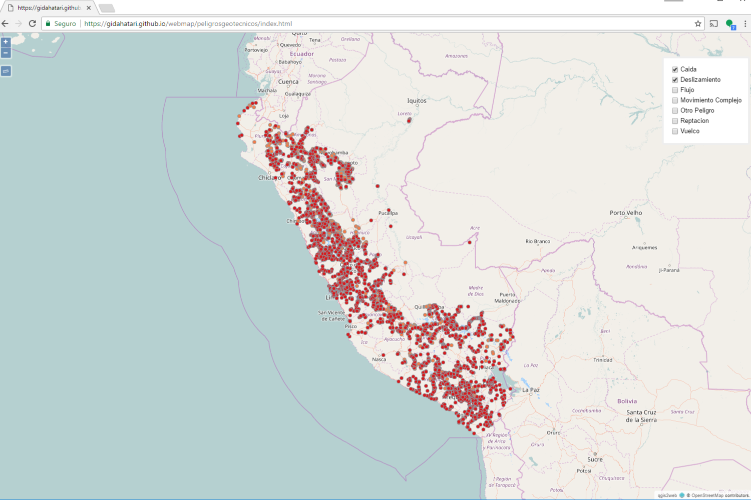
In this way you can see the points that represent geological risks classified in 7 categories. Also, it is possible to measure distances, zoom and click on a point to identify data associated with it, like specified danger and risk estimation.
Web Map
Click on the points to see its data. Activate the layers in the legend located on the right.
You can see the complete web map here: https://gidahatari.github.io/webmap/peligrosgeotecnicos/index.html
QGIS processing
This image shows the data processed in QGIS. The map keeps its styles and also the data information from QGIS.


