Downloading and preprocessing Sentinel 2 images using the Semi-Classification Plugin in QGIS 3.0
/Sentinel-2 carries an innovative wide swath high-resolution multispectral imager with 13 spectral bands (443–2190 nm) (European Space Agency). Sentinel images have a swath width of 290 km and a spatial resolution of 10 m (four visible and near-infrared bands), 20 m (six red edge and shortwave infrared bands) and 60 m (three atmospheric correction bands) (Satellite Imaging Coorporation).The images are very powerful and are of great relevance for land and water management because analyses can be done from the spectral bands, natural color and false color image can be visualized and spectral indices can be obtained. Therefore, downloading them for free is an incredible opportunity for scientists and analysts to meet their goals. This tutorial demonstrates how to download and preprocess Sentinel 2 images using the Semi-Classification Plugin in QGIS 3.0. In addition, how to install the plugin is explained.
Tutorial
Methodology
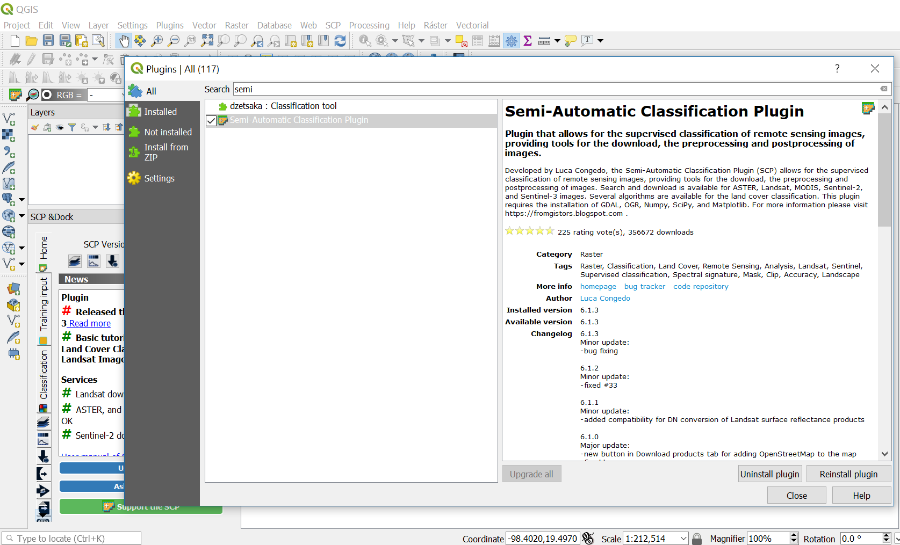
This tutorial starts with the installation of the Semi-Classification Plugin in QGIS 3.0. The powerful plugin, besides offering the semi-classification tool, allows us to download and preprocess satellite images.
In this example, how to use the SCP-Plugin to download Sentinel-2 images will be explained. In addition, this tutorial explains how to create an account on OpenHub to access the images. Then, how to locate the area of interest will be shown and how to select the chosen images with the plugin. The download processing window has 3 tabs, the Login data, the Search and the Download options one. In the Login data one we will introduce the account information obtained in OpenHub. In the Search one, we can write the search parameters by introducing the coordinates of the study area or we can select the location by clicking on the Set Area in the Map icon. Moreover, in the same window, we will select the Preprocess image option so we will not have to preprocess it separately.
Finally, after downloading and pre-processing the Sentinel-2 image, how to create a natural color image will be demonstrated. To do so, the Build Virtual Raster tool will be used and the RGB bands will be displayed at the end.
References
European Space Agency, consulted on 04/04/2018 https://www.esa.int/Our_Activities/Observing_the_Earth/Copernicus/Sentinel-2/Introducing_Sentinel-2
Satellite Imaging Coorporation, consulted on 04/04/2018 https://www.satimagingcorp.com/satellite-sensors/other-satellite-sensors/sentinel-2a/


