Labelling and Clipping using Hydrologic Information of a Basin in QGIS 3.0 - Tutorial
/Presenting Geographic Information Systems (GIS) is of great importance to transmit the correct ideas of the analyzed information. QGIS 3.0 is a powerful software to design and present maps. GIS can contain diverse and vast information; however, the analyst should decide what to present and how to present it. Therefore, labelling is a skill that must be developed when creating maps. This tutorial shows how to clip features to the shape of the study area and how to label the features of interest. The study area is a basin within the state of Tlaxcala, Mexico and it has a channel network shapefile and points with the name of the channel network features. The explanation includes how to create an expression to label the features using conditionals and how to change the style of the labels using QGIS 3.0.
Tutorial
Methodology
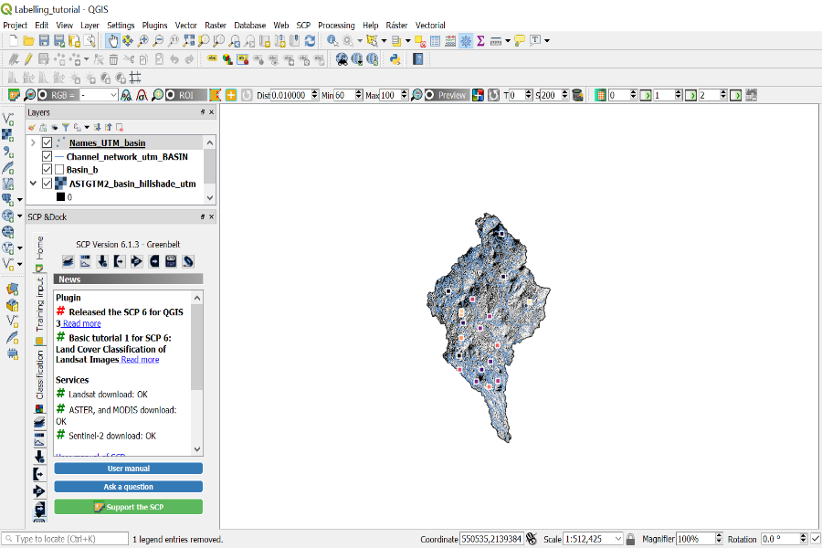
First, the layers of the hydrological properties of the study area will be added to a new project in QGIS 3.0. The layers used in this tutorial are a hillshade map, the channel network and the point file with the names of the streams. The Add Vector and Add Raster tools will be used.
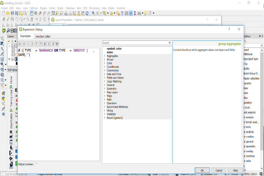
Since the point file contains the names, we will label said layer. To do so, we will right click on the layer and open Properties, then click on the Labels tab. Then, we will select Show labels for this layer nd we will create an expression to label the names of the layer with the Epsilon button:
Finally, we will modify the text properties and the style of the labels with the available options in QGIS 3.0 such as the formatting option which allows us to create multiple lines on labels.


