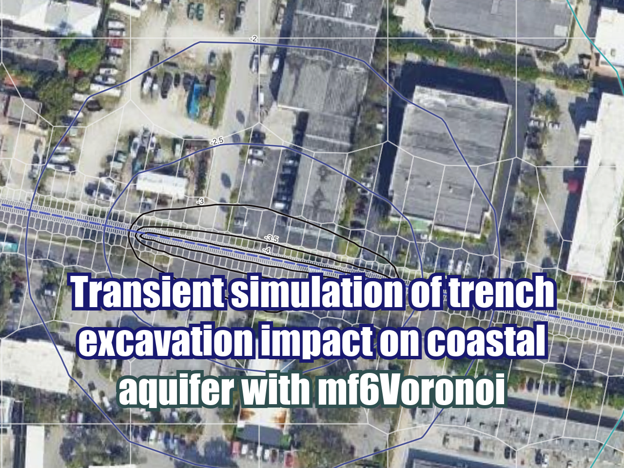
How to make a geospatial Rest Api web service with Python, Flask and Shapely - Tutorial
/Geospatial analysis is not limited to a single desktop software or a python kernel; if you use massive spatial analysis or if you work on a team that want some specific spatial output the use of a Rest Api might be convenient. We have developed a basic, introductory but clear tutorial of a geospatial Rest Api that implements the Post method and Get method and returns the centroid of a polygon and the list of elements with their coordinates respectively. Tutorial is done in Windows, however a real Rest server that runs several high energy spatial queries is expected to run in Linux.
Read More