

How to make a lake bathymetric map with QGIS - Tutorial
/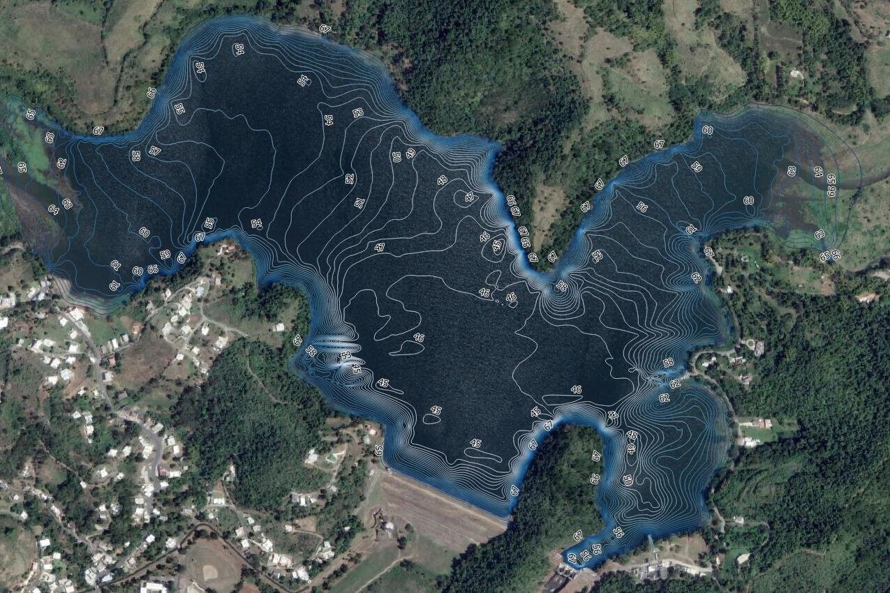
Bathymetric data requires some spatial processing on QGIS to represent lake bottom elevation contours and lake depth. This tutorial shows the complete procedure to analyse a bathymetric survey on the Lake Patillas in Puerto Rico with QGIS to generate:
Lake bottom DEM
Lake bottom contours
Lake depth DEM
Lake depth contours
Input data
You can download the input data from this link:
https://www.sciencebase.gov/catalog/item/5f45726282ce4c3d12251b6e
Processing data can be downloaded from this link.


