

How to make an Environmental Impact Assessment (EIA) using only Open Source software?
/
The study of the environment, the understanding of the water cycle / atmospheric processes and the interaction with the aquatic and terrestrial ecosystems need advanced analysis tools. It is important to understand how the environment works and the potential impacts of our actions in the future. This goes further than a regulatory approach, we need a constant search and evolution of codes and models and this is where open source software has important advantages.
This article shows the most important open source software that can be used to make the different sections of an EIA.
Open source software is good and acknowledged
Some people think that open source software is bad or has limitations. If these people are in charge of evaluating the environment and of understanding the complexity of nature, then the situation is critical.
Free software is free because it does not require a monetary cost to use it. Some of the reasons why it is free are shown below:
- It has been programmed by institutions like EPA, ESA or USGS whose business is not to sell software, so they can distribute it for free.
- They can also be made by a group of developers who are part of a collaborative project where they develop a software and decide to make it free.
- Software generated as part of a research project and then it is distributed.
We have yet not heard about a bad open source software, but we are free to listen opinions from you. If that is the case, we would recommend you another free software that tops the previous one.
For Text and Data processing
To process text documents you can use LibreOffice (https://www.libreoffice.org/) which is the free version of Microsoft Office. The packages are similar to the ones we already know about:
- Microsoft Word is LibreOffice Writer
- Microsoft Excel is LibreOffice Calc
- Microsoft Power Point is LibreOffice Impress
For the analysis of long time series data we recommend Python (www.python.org) through the Anaconda suite (www.continuum.io/downloads). Also R (www.r-project.org), which is a good option that processes continuous data and spatial files.
For spatial data analysis and generation of maps
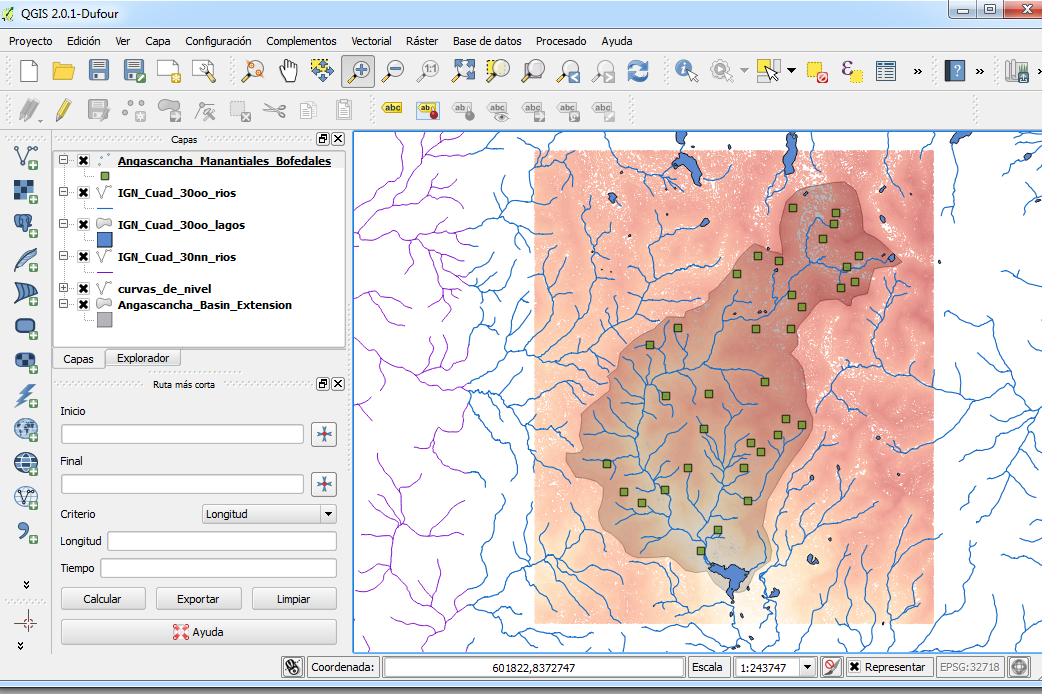
Our main recommendation is QGIS (www.qgis.org). This software has grown a lot in the past few years and the version 3 is around the corner. QGIS lets you process, analyze and represent vectorial datasets and rasters.
In QGIS you can represent populations, ecosystems, water bodies, define influence and affected zones.
For air quality modeling
To model the discharge of emissions from chimneys the best option is Aermod, which is developed by the EPA (https://www3.epa.gov/scram001/dispersion_prefrec.htm). It is easy to use since it performs a 2D calculus. For more complex configurations and 3D modeling we recommend OpenFoam (www.openfoam.org).
For hydrological modeling
To represent precipitation, runoff and storm events on a daily scale, we recommend HEC-HMS (http://www.hec.usace.army.mil/software/hec-hms/). This software has a great GUI and is easy to use. The software lets you implement several hydrological rainfall, loss, runoff and routing models.
SWAT (http://swat.tamu.edu) is also an interesting software since it lets you perform hydrological and water quality modeling. It can also be used as a QGIS complement.
To model the mixing zone related to discharge points, OpenFOAM is recommended (www.openfoam.org). This software is for fluid modeling, may be water or air, and can model laminar or turbulent, miscible or immiscible, compressible or incompressible conditions
To model groundwater flow
Our number one option and the one we are more experienced in is MODFLOW (http://water.usgs.gov/ogw/modflow/), which is a code to model saturated and unsaturated groundwater flow in 3D in regional and local scale. MODFLOW can represent different elements that affect groundwater flow such as wells, recharge, evapotranspiration, among others.
Contaminant transport can be coupled to the MODFLOW flow model using the code MT3DMS.
We hope that this list can show you a new perspective of the current status of open source software to evaluate the environment and potential impacts. We will always support an environmental evaluator interest in research and has critical-thinking and uses free software.


