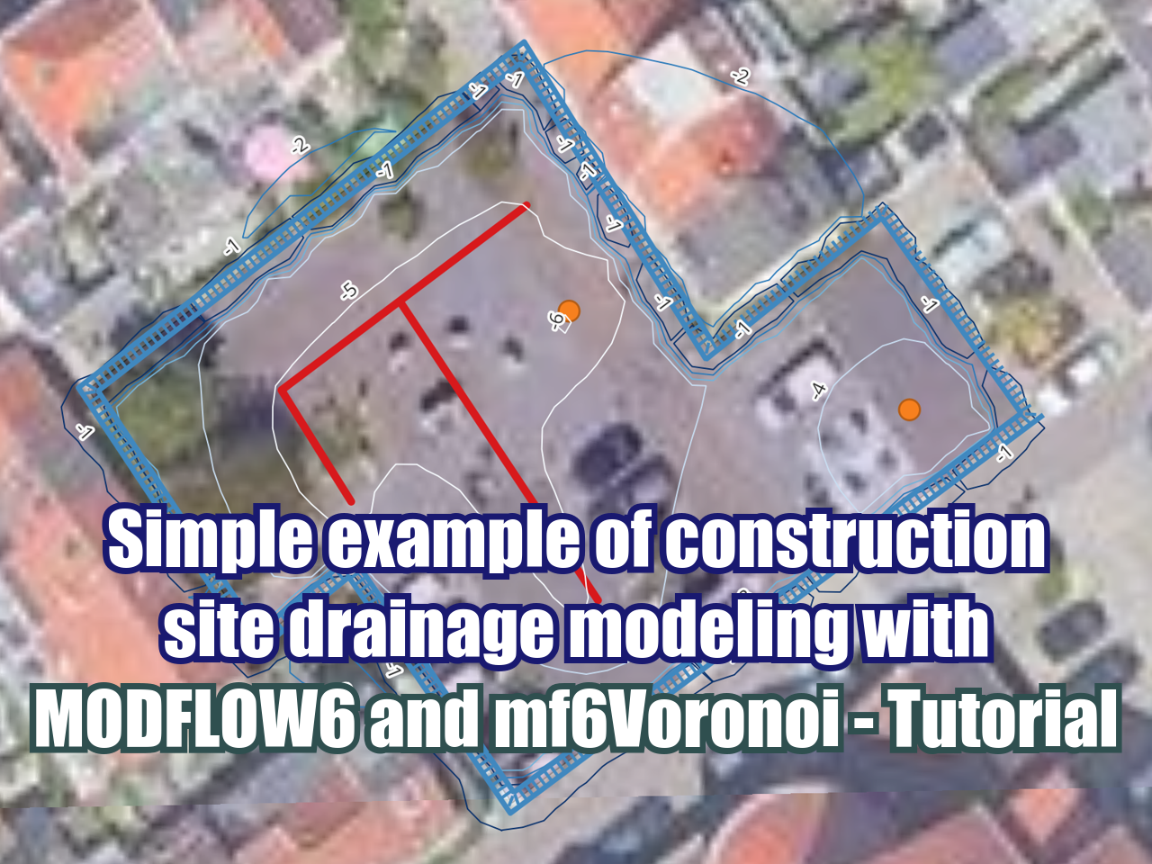
State of the art of open digital elevation imagery and online watershed delineation - Tutorial
/The processes of working with digital elevation models (DEMs) and watershed delineation are in constant change over time. Even though the elevation datasets date from 10 years ago; the web servers and tools for data processing have changed in recent years. With online tools such as Hatari Utils, the watershed delineation can be performed in a few steps with practical outputs as vector files and watershed statistics.
Read More